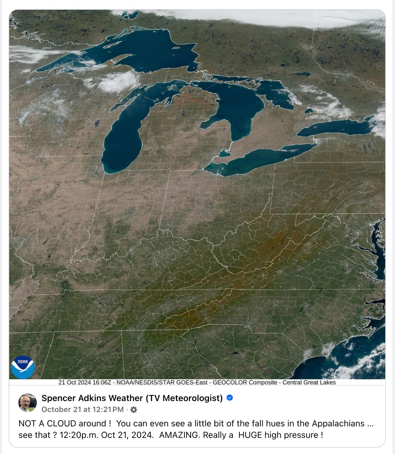
Flying Squid to Mildly [email protected] • 4 months agoThe eastern U.S. was so cloudless last week due to a massive high pressure system that you could actually see fall colors from space.lemmy.worldmessage-square72fedilinkarrow-up1893
arrow-up1893imageThe eastern U.S. was so cloudless last week due to a massive high pressure system that you could actually see fall colors from space.lemmy.worldFlying Squid to Mildly [email protected] • 4 months agomessage-square72fedilink
minus-square@[email protected]linkfedilinkEnglish218•4 months agoWhoa I didn’t know you could see state and county lines from space. I guess maps are more realistic than I thought!
minus-square@anonemooselinkEnglish98•4 months agoImagine how much work it must be to chalk those lines every time it rains.
minus-square@[email protected]linkfedilink44•4 months agoBro this ain’t the 1800s, we’re obviously using LED light strips for that now. The downside is that a single section goes dark and we lose mapping data for the entire northeast. Totally worth it though when they turn on the strobe effect.
minus-squareFlying SquidOPlinkfedilink50•4 months agoI’m no weatherologist, but I think those may just be temporary.
minus-square@[email protected]linkfedilinkEnglish50•edit-24 months agoWhat does weatherology have to do with landology? Educate yourself
minus-squareFlying SquidOPlinkfedilink38•4 months agoDo I look like someone who went to university college to you?
minus-square@[email protected]linkfedilinkEnglish30•4 months agoIf I knew what those words meant, I’d probably be offended
minus-square@[email protected]linkfedilink10•4 months agoThere’s some fanfiction out there that can make you regret learning language at all.
minus-square@[email protected]linkfedilinkEnglish13•4 months agoYou could probably handle lots of different subjects, Squidster


Whoa I didn’t know you could see state and county lines from space. I guess maps are more realistic than I thought!
Imagine how much work it must be to chalk those lines every time it rains.
Bro this ain’t the 1800s, we’re obviously using LED light strips for that now. The downside is that a single section goes dark and we lose mapping data for the entire northeast. Totally worth it though when they turn on the strobe effect.
I’m no weatherologist, but I think those may just be temporary.
What does weatherology have to do with landology? Educate yourself
Do I look like someone who went to university college to you?
If I knew what those words meant, I’d probably be offended
If only I could read
There’s some fanfiction out there that can make you regret learning language at all.
You could probably handle lots of different subjects, Squidster
I can definitely identify wood. I just woke up.