This website contains age-restricted materials including nudity and explicit depictions of sexual activity.
By entering, you affirm that you are at least 18 years of age or the age of majority in the jurisdiction you are accessing the website from and you consent to viewing sexually explicit content.
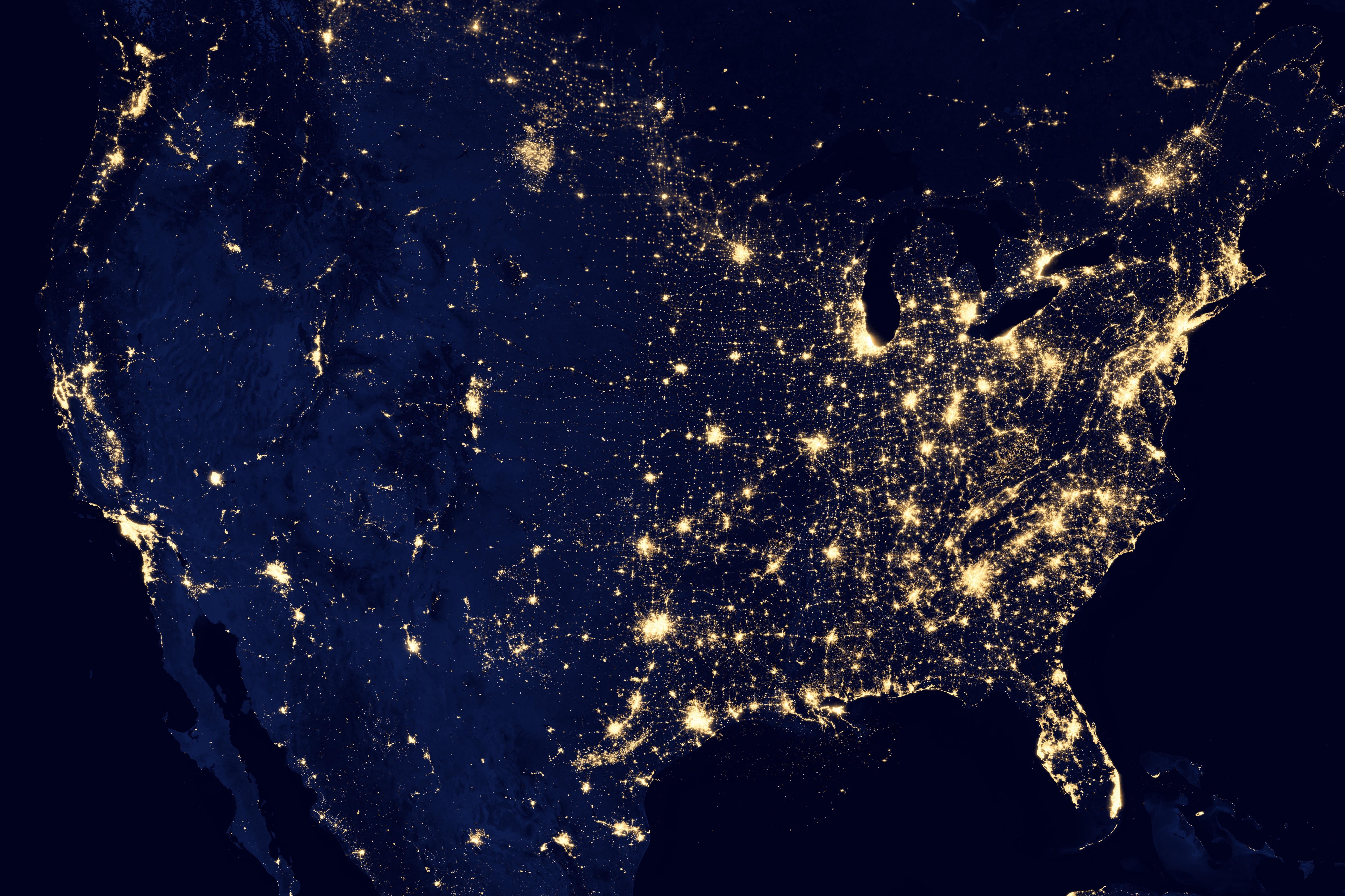
The picture is clearly at the very least a composite, because there are zero clouds anywhere. I was skeptical whether it can be called a “photo”. Given how clear the unlit terrain is, even in the ocean around the Bahamas for example, I thought it must have been a visualization, or a photo of daytime terrain shaded blue and overlaid with a map of nighttime lights. But I found the actual source:
https://earthobservatory.nasa.gov/images/79765/night-lights-2012-map
https://eoimages.gsfc.nasa.gov/images/imagerecords/79000/79765/dnb_land_ocean_ice.2012.13500x13500.B1.jpg
It really is a (composite) photo taken by the Suomi National Polar-orbiting Partnership satellite, whose cameras are so sensitive they can see reflected moonlight and “the nocturnal glow produced by Earth’s atmosphere”, albeit partially in the infrared.
I’m unsure though what “assembled from data” means exactly. At the very least the colors are artificial, shifted from the infrared-to-green range of the camera into human visual range. This page describes some more how the sensor functions, along with raw photos:
https://earthobservatory.nasa.gov/features/IntotheBlack